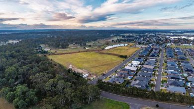
Hawkesbury Suffers Its Second Big Flood in a Row…
By Tony Bosworth | Editor Hawkesbury Post
Two major floods in two years – it’s certainly been a tough couple of years for the Hawkesbury and this time it almost seemed like two floods, with a lull in the middle and then flood heights in some areas almost up to the 1978 level.
Of course, we all should have been used to it the second time around and it has to be said there was a higher level of calmness in general across our region as the waters started to rise.
There will be questions too once this is over about what lessons Hawkesbury Council learnt from the last flood including around some roads still not fully repaired after the 2021 flood, roads which were once again smashed, and an evacuation centre west of the river not opened or even revealed until people had actually been evacuated from their homes.
When the waters rose, and first – as always – swept over Yarramundi Bridge, there were no sandbags readily available through the SES or Council and just 15 minutes before North Richmond Bridge went under it was announced a sandbag point had been opened at McQuade Park in Windsor – not a safe option for those west of the river with Windsor Bridge threatened too.
McQuade Park was the same sandbag venue as last year, and Penrith had sandbags neatly stacked for residents to pick up from Jamison Park a good 24 hours earlier, so you’d wonder why McQuade wasn’t opened sooner, given we all had a fair idea what was coming our way, thanks to last year’s drenching.
Once North Richmond bridge went under – and no-one took the side rails down which means an extended wait once it reopens – it meant those on the west side had no access to sandbags. Shortly after Northo bridge was engulfed, Council announced those on the west could get sandbags from the depot at Wilberforce, an hour round trip for many along increasingly flooded and potholed roads during a downpour.
Things happened quickly after that – the first evacuation was all residents of 13 streets in North Richmond because the SES had concerns about Redbank Dam failing. This was a new one to pretty much everyone. Locals who were being told to evacuate immediately for fear “the Dam” might fail called Hawkesbury Post confused and afraid, and also asked where our evacuation centre was.
At that stage there wasn’t one, despite calls – most stridently from Macquarie MP Susan Templeman all this last year – for a specific centre for west of the river. As evacuations began Merroo Christian Centre at Kurrajong was opened as the main west of the river evacuation centre..
Last flood, almost a year ago, evacuees congregated at North Richmond Community Centre but this year that risked being in the firing line, or the flood, if the Redbank Dam burst, so it wasn’t a possibility.
Redbank Dam – actually two of them, named 13 and 14 – were tagged with an Amber and a Red alert by the SES.
They sit on the new Redbank housing development above North Richmond. The SES had been concerned about those dams because heavy rain had been falling for days. They escalated the concern up the chain of command and all the way to SES HQ who gave the Amber and Red orders their tick.
Redbank Community – the property developer – said the SES had made a mistake and there was no concern, but as a senior Hawkesbury SES officer told the Post, “far better to be safe than sorry”.
As it happened residents were able to return home a couple of days later, given the all clear, though in truth many had returned after only a day away and some didn’t even leave. In a twist to the tale, days later a heritage-listed Dam above the sprawling building site did overflow, causing concern among locals, but there was no disaster, with that Dam feeding into one of the new dams, ironically one that had previously had the SES order placed on it.
As the rain continued to fall and the rivers grew rapidly, Windsor’s fairly new $137m bridge went under the waters for the second time in just under a year, effectively cutting the community in two, though in truth by then there were various islands of communities out there.
One lesson that had been heeded from 2021, by the SES in particular, was that the folks living in some of our more remote areas, particularly Upper Colo and the Macdonald Valley, needed emergency support quick. Last time around the Macdonald Valley – known by locals as Forgotten Valley because, well, they are often forgotten about, only had one single police officer to help with catastrophic flooding. Council’s much vaunted Emergency Dashboard didn’t cover closed roads in the Macdonald Valley. Back in 2021, it took 4 days for the SES to arrive on scene and locals were furious.
This time the SES were on the ground – or rather in their boats – from day one, delivering foods, medicines, and other supplies, and picking up trapped locals who wanted to get back on some dry land. SES and RFS helicopters were also busy across our region on both rescue and resourcing runs. There were some complaints rescue boats were being driven too fast on the rivers, the wash sweeping into already waterlogged houses on some occasions. The police officer based at Wisemans Ferry brought up community concerns about this with the SES.
Other issues revolved around Council’s lack of progress on critical road repairs, especially at Lower Portland where locals are tired and frustrated by the almost year’s wait for repairs to 2 one kilometre stretches which have not bee finished and now suffered even more damage.
At Wisemans Ferry many locals were essentially trapped after landslides came down blocking Settlers Road. This year councillors briefly discussed allowing local contractors to step in when Council workers couldn’t get to remote areas. But so far it’s come to nothing so locals step in anyway – they have to, otherwise the would be waiting a very long time for help.
There was a lull before the next stage, which saw another mass of rain combining with already swollen rivers, full dams upstream, and ground that couldn’t take any more. That’s when the major evacuations began, the low-lying and flood prone areas, Sackville, Colo, McGraths Hill, even some parts of Windsor, plus many others.
Then power was cut to hundreds of homes because of safety concerns and for the first time the lights went off at the new Windsor Bridge. Last flood they were almost a beacon of hope as they continued to shine even while the bridge was swallowed by the river.
It will take days before river levels go down sufficiently to get the power back on, some in more remote areas may wait almost a week.
It’s beginning to look like the waters will go down soon, with a peak at Windsor above the 2021 flood but below the infamous 1978 event which literally re-shaped river banks and river flow.


